

The Glyderau: A Walking Guide to Snowdonia's Most Spectacular Mountains
The Glyderau is a mountain group in Eryri (Snowdonia) which includes the peaks of Glyder Fawr, Glyder Fach & Tryfan. The mountain group also includes the iconic rock formations of the Devil's Kitchen, Castell y Gwynt and the Cantilever Stone.

Why the Glyderau Deserve Your Attention
The Glyderau offer some of the best mountain walks in Eryri (Snowdonia), and most visitors walk straight past them.
The Glyderau (pronounced gli-DER-eye, and sometimes anglicised as the Glyders) stretch between the Ogwen Valley and the Llanberis Pass, directly opposite Yr Wyddfa (Snowdon).
The two main peaks, Glyder Fawr (1,001m) and Glyder Fach (994m), sit at the heart of the range. Their summits are unlike anything else in Wales: vast plateaus of shattered rock, teetering boulders balanced at impossible angles, and jagged spires that look more like Iceland than Eryri (Snowdonia).
The word "Glyder" derives from the Welsh cludair, meaning a heap or pile. Stand on the summit plateau of Glyder Fach and you will understand why. It is a landscape of chaos and scale, scoured by ice and shattered by frost over hundreds of thousands of years.
The range also includes Tryfan, Snowdonia’s most famous scramble, plus minor satellite peaks (Y Garn, and Elidir Fawr, Carnedd y Filiast, Mynydd Perfedd, Elidir Fach, Foel Goch. Castell y Gwynt & Y Foel Goch). But the focus here is Glyder Fawr and Glyder Fach, their landmarks, and the beautiful Cwm Idwal walk that sits below them.
The Walk Snowdonia guides know every path in the Glyderau, from the gentle Cwm Idwal lakeside walk to the full ridge traverse. See our guided Glyderau walks.
If you have already climbed Yr Wyddfa (Snowdon) and are wondering what comes next, or you are simply looking for the best mountains in Eryri (Snowdonia), this is your answer.

Glyder Fawr and Glyder Fach: Quick Facts
There are three main ways to experience the Glyderau, and they suit very different walkers. The gentle Cwm Idwal walk explores the valley floor and its glacial lake without a summit.
The classic Ogwen circular takes in both Glyder Fawr and Glyder Fach along with the Cantilever Stone and Castell y Gwynt.
And for confident scramblers, the ridges of Y Gribin and Bristly Ridge offer a hands-on route onto the plateau.
Whichever you choose, the sections below cover the practical detail you need to plan your day.

Cwm Idwal and the Devil's Kitchen: An Easier Walk in the Glyderau
The Cwm Idwal walk is one of the finest short mountain walks in Wales. The circular route from the Ogwen Valley visitor centre to Llyn Idwal and the Devil's Kitchen viewpoint covers approximately 5 km with 200m of ascent, taking 2 to 3 hours.
It is suitable for most reasonably fit walkers, including younger and older children. The upper path at the back of the cwm involves some steep and rocky sections near the Devil's Kitchen itself.
Cwm (pronounced koom, meaning a bowl-shaped valley) Idwal is Wales's oldest National Nature Reserve and one of the most geologically significant landscapes in Britain. Charles Darwin studied here in 1831 and again in 1842, and his observations of the glacial features in this valley helped shape his thinking about how ice had sculpted the landscape. Standing beside Llyn Idwal, ringed by 300-metre cliffs, it is easy to see why the place captured his attention.
The walk begins at the Ogwen visitor centre and follows a well-constructed stone path up into the cwm. Within 20 minutes, Llyn Idwal opens up in front of you, a dark lake cradled in a natural amphitheatre. The path circles the lake, and on a still day the reflections of the surrounding cliffs are extraordinary.
At the far end of the lake, look up at the cliff face of Clogwyn y Geifr. The dark vertical cleft splitting the rock is the Devil's Kitchen, known in Welsh as Twll Du (pronounced too-ll dee), meaning the Black Hole. In wet weather, a waterfall pours down through it. In certain conditions, plumes of mist rise from the cleft like steam from a cooking pot, which is where the English name comes from.
You will also pass the Idwal Slabs, the huge sweep of smooth rock on the eastern side of the cwm. This is one of the most famous rock climbing venues in Britain and you will almost certainly see climbers on it. Watching them from the path is part of the experience.
You do not need to climb through the Devil's Kitchen to enjoy this walk. The circular route around Llyn Idwal is a complete and rewarding outing in its own right. For more short walks in the area, see our guide to easy walks in Snowdonia.
For the full picture on the reserve, the Cwm Idwal National Nature Reserve pages from Natural Resources Wales and the Cwm Idwal page on the Eryri National Park website are worth a read before you visit.
Want to explore Cwm Idwal and the Devil's Kitchen with a local guide who can share the geology, the Darwin connection, and the stories behind the landscape? This is particularly good for schools and scouts. Contact us for more information.

Walking Routes to Glyder Fawr and Glyder Fach
Every route to the Glyderau summits is classified as hard. There is no easy way up. The paths are unmarked, rough underfoot, and the upper plateau is genuinely featureless and surrounded by cliffs or scree covered slopes.
Navigation skills are essential and people get lost up here all the time. It is worth noting that it is significantly harder to navigate than any of the routes up Yr Wyddfa (Snowdon). This is particularly true on the summit plateau where precise routefinding are essential to avoid the north facing cliffs which sit between the summit and Ogwen Visitor Centre. I have had to rescue lost hikers on the Glyderau numerous times.
The reward is a mountain experience utterly unlike Yr Wyddfa (Snowdon). Instead of a summit cairn, a railway, and a cafe, you get a vast field of shattered boulders, the gravity-defying Cantilever Stone, and the jagged spires of Castell y Gwynt.
If you are new to mountain navigation, read our map reading guide before you go or join a navigation course.
The Classic Glyderau Circular via Cwm Idwal and the Devil's Kitchen
The classic Glyderau circular from the Ogwen Valley covers approximately 9.5 km (6 miles) with 820m of ascent and takes 5 to 6 hours. It climbs through the Devil's Kitchen to Llyn y Cwn, takes in both Glyder Fawr and Glyder Fach summits along with Castell y Gwynt and the Cantilever Stone, and descends past Llyn Bochlwyd back to Ogwen.
This is the route Walk Snowdonia uses for most guided Glyderau walks, and it packs more drama into six miles than almost anything else in Eryri (Snowdonia).
Start from the Ogwen visitor centre and follow the path into Cwm Idwal. Take either path beside the lake. At the head of the cwm, both paths steepen sharply before merging and climbing into the Devil's Kitchen. This section is the crux of the ascent: steep, loose rock with several places where you will need your hands. It is not technical scrambling, but it demands care, particularly when the rock is wet.
You emerge onto the plateau beside Llyn y Cwn, a small lake in a shallow saddle between Glyder Fawr and Y Garn. Turn left (south) and climb the rocky slope to the summit of Glyder Fawr. The gradient eases as you gain the plateau and the landscape transforms into a chaos of shattered rock. The summit itself is marked by a cluster of rock spires rather than a conventional cairn.
From Glyder Fawr, head east across the plateau towards Glyder Fach. This is the finest section of the walk. The path threads between boulder fields with Tryfan's dark bulk ahead and the Carneddau beyond. After roughly a kilometre, you reach Castell y Gwynt, the extraordinary rock formation described in detail below.
Beyond Castell y Gwynt lies Glyder Fach and, the famous Cantilever Stone.
For the descent, pick up either the path heading down to Bwlch Tryfan, the col between Glyder Fach and Tryfan. This descent is steep and loose especially the direct path to the side of Bristly Ridge. The easier but longer route is the path east which joins The Miner’s Track before switching back north west to the bwlch. From Bwlch Tryfan, follow the path down past Llyn Bochlwyd, then continue on the well-worn track back to the Ogwen visitor centre.
Allow the full 5 to 7 hours. This is not a route to rush, and the scree slopes and boulder-hopping across the plateau is slower than the distance suggests.
Scrambling Onto the Glyderau: Y Gribin and Bristly Ridge
For walkers comfortable with Grade 1 scrambling, two ridges offer exciting routes onto the Glyderau plateau. Grade 1 scrambling means using your hands regularly to climb over rock, with some exposure, but it is not rock climbing and no ropes are needed in good conditions. The British Mountaineering Council has a useful explanation of scrambling grades if the term is new to you.
Both ridges below are serious undertakings especially in wet weather, when the rock becomes slippery or wind when the hazards intensify. Neither should be attempted in winter without winter mountaineering skills and equipment.
Y Gribin is the gentler of the two and the better introduction. This rocky ridge rises directly from Llyn Bochlwyd to the plateau between Glyder Fawr and Glyder Fach, depositing you 400m from Castell y Gwynt.
The scrambling is straightforward on large holds and the exposure is manageable. There are easier lines around most of the harder steps. It is often described as the most accessible scramble in the Glyderau, and it makes a superb ascent when combined with a Devil's Kitchen descent for a varied circular.
Bristly Ridge is the more demanding of the two and one of the finest Grade 1 scrambles in Wales. It rises from Bwlch Tryfan, the col between Tryfan and Glyder Fach, climbing roughly 200m of steep, pinnacled rock directly to the Glyder Fach plateau. The ridge is sustained, the rock is superb in places and loose in others, and the route-finding is challenging. The usual start is up Sinister Gully at the left-hand end of the ridge, though several variations exist. Once committed, escape options are non-existent.
Although both are Grade 1 scrambles, Bristly Ridge is noticeably harder than Y Gribin. The exposure is greater, the scrambling is more challenging and more sustained, and there is loose rock throughout. It suits confident scramblers with a solid head for heights, not walkers looking to try scrambling for the first time.
Bristly Ridge is most often combined with Tryfan's North Ridge and Y Gribin to create one of the great mountain days in Britain: The Bochlwyd Horseshoe.
The Pen y Pass Approach: A Quieter Alternative
The Glyderau can also be climbed from the south, starting at Pen y Pass at the top of the Llanberis Pass. From the car park, a path climbs north east of north west, rising steadily across the southern flank of the range towards Glyder Fawr.
This approach is much quieter than the Ogwen routes and the gradient is more forgiving. The views back across the Llanberis Pass to Yr Wyddfa (Snowdon) are outstanding, and on a clear day you can trace the Pyg Track and Crib Goch on the opposite side of the valley.
It could be argued that it is less dramatic than climbing through the Devil's Kitchen and you miss Cwm Idwal entirely. But on a busy summer weekend when Ogwen is full by 8am, it is a legitimate and rewarding alternative. Note that Pen y Pass parking must be pre-booked in the main season.

The Cantilever Stone: Glyder Fach's Famous Landmark
The Cantilever Stone is a large flat slab of rock projecting horizontally from a boulder on the summit plateau of Glyder Fach, appearing to defy gravity. Walking out to the end of it and posing for a photograph is a rite of passage for Eryri (Snowdonia) walkers.
The stone is roughly 8 metres long and rests on a supporting boulder in a way that looks entirely improbable. It has been there for thousands of years and has held the weight of countless walkers, who have tried to get it to move. Clambering onto the stone is good fun and standing on the top can be too scary for some. The drop beneath the projecting end certainly focuses the mind.
Finding it is relatively easy in good visibility: from the summit rocks of Glyder Fach, head a short distance southeast and it is unmistakable. In cloud, it can be surprisingly hard to locate among the featureless boulder field, which is one of the reasons a compass bearing matters up here.
It is the most photographed landmark in the Glyderau and the image most people share afterwards. If you have seen a picture of someone standing on an impossibly balanced rock in Wales, this is almost certainly it.

Castell y Gwynt: The Castle of the Wind
Castell y Gwynt translates as the Castle of the Wind, and it is the single most striking feature on the Glyderau ridge.
Sitting on the plateau between Glyder Fawr and Glyder Fach, it is a dense cluster of frost-shattered rock spires rising from the ridge like the ruins of a fortress. The formation is the product of hundreds of thousands of years of freeze-thaw weathering, water seeping into cracks, freezing, expanding, and splitting the rock apart layer by layer.
The path either goes directly through the formation, involving some easy scrambling over and between the spires, or bypasses it on the southern side. In strong wind, the name is entirely self-explanatory and the bypass is the sensible choice.
On a clear, calm day, this is one of the finest viewpoints in Eryri (Snowdonia). Tryfan sits below and to the north, the Carneddau roll away beyond it, and Yr Wyddfa dominates the skyline to the south across the Llanberis Pass.
The combination of Castell y Gwynt and the Cantilever Stone, encountered within a kilometre of one another on the same plateau, is what makes the Glyderau traverse feel genuinely otherworldly. There is nowhere else quite like it in Wales.

How Hard Are the Glyderau?
The Glyderau are hard mountain walks. Reaching Glyder Fawr or Glyder Fach involves steep, sustained ascent, rough and rocky terrain throughout, unmarked paths, and a summit plateau that is genuinely disorienting in cloud. The gentler Cwm Idwal walk is the exception: it stays low and is manageable for most walkers.
The difficulty is less about any single steep section and more about the sustained demands of the day. The ground is rocky and awkward, especially the steep ascent & descent (pictured) and the boulder fields slow your pace to well below what the distance suggests. Across much of the upper plateau there is no path whatsoever.
Navigation is the real challenge. In clear weather the route is relatively obvious, but when cloud drops onto the tops, the featureless expanse of shattered rock becomes one of the easiest places in Wales to lose your bearings. There are cliffs between the summit plateau and Ogwen Valley so the consequences of getting lost can be severe. A map and compass, and the ability to use them, are essential. Add the scrambling ridges of Y Gribin and Bristly Ridge and the difficulty rises again.
None of this should put off a fit, experienced and well-prepared walker. But the Glyderau reward respect and punish complacency, which is exactly why so many people choose to walk them with a guide.
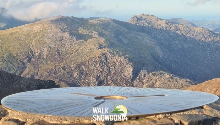
The Glyderau vs Yr Wyddfa (Snowdon): A Different Mountain Experience
Are the Glyderau harder than Yr Wyddfa (Snowdon)? Generally, yes. The summit routes are more demanding than the Llanberis Path, the Pyg Track, or the Miners' Track, mainly because of the rougher terrain and tougher navigation. The Cwm Idwal walk, by contrast, is easier than any route up Snowdon.
But the more interesting difference is not difficulty. It is the character of the day.
Yr Wyddfa (Snowdon) has the height, the fame, and the infrastructure: six well-maintained routes, a summit building, a mountain railway, and half a million walkers a year. It is a magnificent mountain and there is a reason it is popular. Read our Snowdon routes guide if that is where you are headed.
The Glyderau offer something else entirely: adventure, solitude, and the feeling of genuine mountain exploration. Even on a busy August Saturday, the Glyder Fach plateau is quiet compared with the summit of Yr Wyddfa (Snowdon). The landscape is more dramatic and more unusual. There is no cafe, no train, and no easy way down if the weather turns, which means the mountain gives more back precisely because it asks more of you.
The two ranges face each other across the Llanberis Pass, separated by little more than a valley. If you have walked the Llanberis Path and looked across at the rugged skyline opposite, that was the Glyderau.
Our verdict: if you loved Yr Wyddfa (Snowdon) and want to go deeper into Eryri (Snowdonia), the Glyderau are the natural next step.
The Wider Glyderau Range: Tryfan, Y Garn, and Elidir Fawr
Glyder Fawr and Glyder Fach are the centrepiece, but the range holds several other outstanding peaks. Here is a brief orientation to help you plan future days out.
Tryfan: Snowdonia's Most Iconic Scramble
Tryfan (918m) has the most recognisable mountain profile in Wales, a sharp rocky pyramid rising straight from the shores of Llyn Ogwen. Its North Ridge is one of the most popular scrambles in the country and includes the iconic Cannon Stone plus the twin monoliths of Adam and Eve on the summit which have tested nerves for generations. It is a mountain that demands scrambling ability on every route to the top. We have covered it separately and in depth: read our full guide to Tryfan.
Y Garn and Elidir Fawr: The Western Glyderau
Y Garn (947m) rises directly above Cwm Idwal and is reached from Ogwen via its north-east ridge. The views down into the cwm from the summit are among the best in the range, with Llyn Idwal directly below and the Devil's Kitchen cleft visible in profile. It combines naturally with Glyder Fawr for a longer day.
Elidir Fawr (924m) sits at the western end of the range. It is the quietest of the major Glyderau peaks and never busy even in high summer. Both peaks form part of the Welsh 3000s challenge, where the Glyderau make up the demanding middle section of the traverse.

Parking and Getting to the Glyderau
Almost all Glyderau walks start from the Ogwen Valley on the A5. Parking is limited and fills early, so plan ahead.
Ogwen Valley: Idwal Cottage and the A5 Lay-bys (2026)
The Ogwen Centre car park (Idwal Cottage, LL57 3LZ) is the main starting point for Cwm Idwal, the Devil's Kitchen, and the Glyderau circular.
Cost: £6 per day / £3 up to 4 hours (card and contactless only, no cash)
What3Words: ///pushover.trailers.deflected
Facilities: Toilets, seasonal cafe or kiosk (check before you go), EV charging on site
Capacity: Small. Typically full by 9am on summer weekends and bank holidays.
There are additional lay-bys along the A5 on both sides of the road. These are free but fill early and double yellow lines have been painted along parts of the A5 to stop dangerous roadside parking. Do not park on the yellow lines. Vehicles are ticketed.
If Ogwen is full, the TrawsCymru T10 service stops in the Ogwen Valley, running from Bethesda, Bangor, Betws-y-Coed, and Capel Curig. Parking in Bethesda and catching the bus is a reliable fallback and often the best option on busy weekends such as sunny bank holidays. See the Eryri National Park Ogwen page for current details.
Pen y Pass: An Alternative Start
The southern approach to Glyder Fawr starts from Pen y Pass at the top of the Llanberis Pass. Parking here must be pre-booked in advance during the main season (roughly late March to early November) and it is considerably more expensive than Ogwen. Book early, as the car park is also used for Yr Wyddfa (Snowdon) so spaces sell out in advance on summer weekends.
What to Pack for the Glyderau
The Glyderau are more exposed, rougher underfoot, and harder to navigate than Yr Wyddfa (Snowdon). Pack accordingly.
Waterproof jacket and trousers. Essential on every visit. The plateau is fully exposed and weather moves in fast off the Irish Sea.
Walking boots with ankle support and a stiff, grippy sole. The terrain is rocky from the moment you leave the valley floor and the boulder fields are unforgiving on soft footwear.
Trainers are not suitable.
Multiple layers. The summits are usually cold and windswept. A base layer, a fleece or midlayer, and a shell.
Map and compass. OS Explorer OL17 covers the whole range. The Glyder plateau is genuinely featureless in cloud and the boulder fields swallow paths entirely. Know how to take and follow a bearing. If you are rusty, do a refresher map reading course.
Water: 2 to 3 litres. There is no reliable water source on the route.
Food for the full day. There are no facilities on the mountain.
Headtorch. The Glyderau take longer than most people expect and a torch weighs nest to nothing.
Walking poles. Genuinely useful on the steep descents from Bwlch Tryfan and out of the Devil's Kitchen.
In winter: crampons, an ice axe, and the experience to use them. The Glyderau in winter is serious mountaineering, not walking. The plateau holds snow late, large cornices form over the cliffs and the descents ice up hard.
For general mountain safety advice, Adventure Smart Wales is an excellent resource backed by mountain rescue teams.
Best Time to Walk the Glyderau
May to October offers the best conditions. June and September are ideal: long daylight hours, generally settled weather, and noticeably fewer people than July and August.
The Cwm Idwal walk is enjoyable year-round. The path is well-constructed, the altitude is low, and the cwm is arguably at its most atmospheric in autumn and winter when the waterfalls are in full flow and the cliffs are streaked with ice.
The full Glyderau traverse is a different matter. The summits are frequently in cloud even on days that look fine from the valley, and the plateau in poor visibility is one of the easiest places in Wales to become disoriented. Always check the Met Office mountain forecast for Eryri (Snowdonia) before setting out, and be prepared to turn back.
Winter ascents of Glyder Fawr and Glyder Fach are not recommended without winter mountaineering experience and full equipment. The scrambling ridges are out of the question in snow and ice for anyone without those skills.
Guided Glyderau Walks with Walk Snowdonia
The Glyderau demand strong navigation skills. The upper plateau is featureless in cloud, the paths fade into boulder fields, and the consequences of a wrong bearing are real. This is the range where a guide makes all the difference.
Walk Snowdonia's Mountain Leaders live and work in the shadow of these hills. With a guide, the navigation danger and anxiety disappears entirely, and the landscape opens up in a different way. You learn why the plateau is shattered into a million pieces, how the ice carved Cwm Idwal as well as the myths and legends.
We use the Classic Ogwen Circular as our standard Glyderau route, taking in the Devil's Kitchen, both summits, Castell y Gwynt, and the Cantilever Stone. For groups wanting more, we can adapt the day.
For anyone who has done a guided Yr Wyddfa (Snowdon) walk with us and is wondering what comes next, the Glyderau are the perfect progression. Same mountains, same guides, entirely different experience.
Ready to explore the Glyderau with an expert local guide? Book a guided walk with Walk Snowdonia.
Not sure if the Glyderau are right for you? Get in touch and our team will help you choose the perfect Eryri (Snowdonia) walk for your experience level.


